Street Maps
Street Maps > State Street Maps • City Street Maps • Street Photos
 Maps come in many sizes, scales, and shapes; many maps, depending on their scale, are designed primarily as road maps or
as street maps. A street map covers a smaller area than a road map; it is usually scaled to show the streets in a
city or metro area. The interactive, scalable street maps listed on the following menu show individual states in
the USA, with their cities and towns, roads and streets, airports and seaports, and other points of interest.
Because these maps are scalable, they can zoom in to show street-level details, even on a tablet or smartphone device.
Maps come in many sizes, scales, and shapes; many maps, depending on their scale, are designed primarily as road maps or
as street maps. A street map covers a smaller area than a road map; it is usually scaled to show the streets in a
city or metro area. The interactive, scalable street maps listed on the following menu show individual states in
the USA, with their cities and towns, roads and streets, airports and seaports, and other points of interest.
Because these maps are scalable, they can zoom in to show street-level details, even on a tablet or smartphone device.
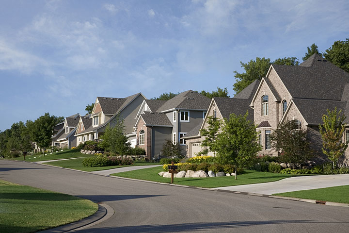 Streets are local roads that provide access to homes, businesses, public buildings, and institutions in a community.
In North American colonial times, streets were places for markets, social events, and celebrations, not just for
foot traffic or horse-drawn vehicle traffic. As communities grew and expanded, towns that began with only a simple
main street added areas that required new streets to accommodate businesses, services, and more homes and churches.
Once the automobile was invented and became popular, streets were added and street surfaces were upgraded to meet
increased traffic demands for easy access to densely-populated areas.
Streets are local roads that provide access to homes, businesses, public buildings, and institutions in a community.
In North American colonial times, streets were places for markets, social events, and celebrations, not just for
foot traffic or horse-drawn vehicle traffic. As communities grew and expanded, towns that began with only a simple
main street added areas that required new streets to accommodate businesses, services, and more homes and churches.
Once the automobile was invented and became popular, streets were added and street surfaces were upgraded to meet
increased traffic demands for easy access to densely-populated areas.
The street maps listed on the following menu show streets in major cities in the USA and around the world.
USA City Street Maps | World City Street Maps | |
|---|---|---|
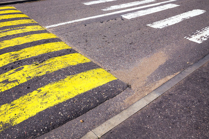
 Today's urban street designers realize how much well-designed streets contribute to a city's public life. Rather
than just being an artery for traffic to flow through, these newly-designed streets provide safe access to shopping, work,
walking, and bicycling. They improve home values and parking as well. Communities are gradually reintroducing
street areas that can be used as playgrounds, front yards, and sidewalk dining. Cities are using street markings,
planters, and other low-cost materials to quickly lay out projects in already-built environments.
Today's urban street designers realize how much well-designed streets contribute to a city's public life. Rather
than just being an artery for traffic to flow through, these newly-designed streets provide safe access to shopping, work,
walking, and bicycling. They improve home values and parking as well. Communities are gradually reintroducing
street areas that can be used as playgrounds, front yards, and sidewalk dining. Cities are using street markings,
planters, and other low-cost materials to quickly lay out projects in already-built environments.
 Safety—for both young and old—is paramount in street design. The designers must provide conditions for
smooth operation of varied types of transportation as well as safe pedestrian access. With safety in mind, 3-D street maps have been developed to help the blind learn to negotiate busy intersections. This mapping
technology uses a 3-D printer that creates raised surfaces and different textures to indicate streets, landscaping, and
sidewalks. Touching the map helps visually impaired users to understand street and intersection layouts.
Safety—for both young and old—is paramount in street design. The designers must provide conditions for
smooth operation of varied types of transportation as well as safe pedestrian access. With safety in mind, 3-D street maps have been developed to help the blind learn to negotiate busy intersections. This mapping
technology uses a 3-D printer that creates raised surfaces and different textures to indicate streets, landscaping, and
sidewalks. Touching the map helps visually impaired users to understand street and intersection layouts.
All rights reserved. About us.